Eastern Suburbs & Illawarra railway line, Sydney
| Eastern Suburbs & Illawarra Line | |
| Overview | |
|---|---|
| Mode | Commuter rail line |
| Area | Hurstville, Kogarah, Marrickville, Rockdale, Sutherland, Sydney |
| Map colour | Azure Blue |
| Owner | CityRail |
| Design | |
| Stations | 33 |
| Connects | Central, Sydenham, Wolli Creek, Hurstville, Sutherland, Cronulla, Waterfall |
| 1884 | Line opened |
| 1926 | Electrification begins |
| 1939 | Cronulla Line opened |
| 1979 | Eastern Suburbs Line opened |
| 1991 | Royal National Park branch closed |
| Operations | |
| Operator(s) | CityRail |
| Fleet | S, T, G sets |
| Depot(s) | Mortdale |
| Public transport | | |
The Eastern Suburbs & Illawarra railway line (popularly known as the Eastern Suburbs & Illawarra Line) is a commuter railway line in the eastern and southern suburbs of Sydney, Australia, that has become part of Sydney's CityRail rail network. Along with the South Coast Line, an intercity line that uses the Illawara Line tracks out of Sydney, the line was originally constructed in the 1880s to Wollongong to take advantage of agricultural and mining potentials in the Illawarra area. In 1926, it became the first railway in New South Wales to run electric train services.
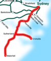
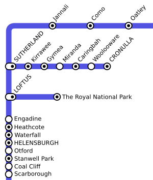
Today the railway consists of three connected lines: the original Illawarra Line; a branch line between Sutherland and Cronulla (the Cronulla Line), which opened on a former tramway alignment in 1939; and an underground rail link between the Sydney CBD and Bondi Junction, the Eastern Suburbs Line, which opened in 1979. The railway currently operates as a relatively high-frequency independent line today, that has been noted by the New South Wales Government to be the most reliable line in Sydney.[1]
Operationally and historically, the entire line from the Illawarra Junction at Redfern to its terminus in Bomaderry on the South Coast was known as the "Illawarra Line", however, since 1989, CityRail has marketed the suburban services to Waterfall and Cronulla as the "Illawarra line" and interurban services south to Wollongong and Bomaderry as the South Coast Line.[2][3] The line is coloured an azure blue on CityRail's timetables and other promotional materials.
Contents
Alignment
Eastern Suburbs Line
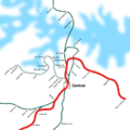
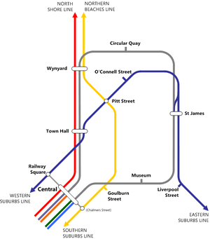
The Eastern Suburbs Line runs between Bondi Junction in Sydney's east and Eveleigh, just south of the Sydney central business district. It is mostly underground, and consists of 7 kilometres of bored tunnels and 1.5 kilometres of cut and cover tunnels, with only 2 kilometres above ground.[4] In the Eastern Suburbs, three tunnels proceed in a northwesterly direction from Bondi Junction under the suburbs of Edgecliff, and Kings Cross; in each of these tunnels there are stations. Between Bondi Junction and Edgecliff there is a short open-air cutting in Woollahra; and between Edgecliff and Kings Cross there is a short viaduct over Rushcutters Bay.
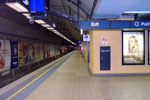
From Kings Cross, the line proceeds west towards the Sydney Central Business District on a viaduct which passes over the suburb of Woolloomooloo and the Eastern Distributor. The line then passes into a tunnel underneath the Art Gallery of New South Wales to a station underneath Martin Place. Turning south, the line proceeds through Sydney's Town Hall, Central and Redfern stations, before emerging behind the railway workshops at Eveleigh.[5] The line is two tracks for its entire length, with turnback sidings at Martin Place and Bondi Junction for citybound trains, and at Central for trains coming from Bondi Junction.[4]
Illawarra and Cronulla Lines
The Illawarra Line commences at the Illawarra Junction at Redfern. A dive tunnel allows Intercity services from the South Coast Line to cross underneath the main suburban railway lines to access Central Station. The Illawarra lines are also connected at this point to the Illawarra Relief Lines which emerge from underground and lead to the Eastern Suburbs Line.
From the Illawarra Junction, four tracks (including the Airport & East Hills Line and Bankstown Line) lead south through the suburbs of Erskineville and St Peters to Sydenham Station, where the Bankstown Line branches off. The line parallels the Airport & East Hills Line tracks until the suburb of Wolli Creek. After it reaches the suburb of Carlton the railway turns in a westerly direction towards the suburb of Hurstville, then continues south towards Sutherland, crossing the Georges River between the suburbs of Oatley and Como. At Sutherland the Cronulla Line branches in an easterly direction until Woolooware where the branch turns south and finishes in the middle of the Cronulla shopping area.
The main line then heads in a southerly direction, paralleling the Princes Highway to the west and bordering the Royal National Park on its eastern side until Waterfall, the last suburb in the Sydney metropolitan area. The line continues south from here as the South Coast Line through the National Park.
The line is four tracks between Wolli Creek Junction and Hurstville, then two tracks between Hurstville and Waterfall. Sutherland has a third platform for the Cronulla Line.[5]
History
Main line construction
The idea for a railway between Sydney and the Illawarra area was first raised in the 1870s. At that time, railways to the north, west and southwest of Sydney had already been constructed, and a committee of prominent citizens formed to investigate the idea felt that a railway might help to develop agricultural and mining potentials in the Illawarra. In 1873, the committee asked the Government Surveyor, Mr R. Stephens, to examine the area between Sydney and Bulli for a suitable route. The suggested route led from Rozelle in inner-western Sydney (at the site of the former Balmain Power Station), crossing the Georges River at Tom Uglys Point, climbing the Gwawley Range on a steep gradient, then following the Port Hacking River towards Stanwell Park. The railway connected to the main line at Petersham Station.[6] When Stephens went to survey the route, he encountered many difficulties with terrain, especially between Gymea Bay and the Port Hacking River, as well as along the river itself. Stephens noted his concerns about the Gymea Bay-Port Hacking route in a letter to the Engineer-in-Chief of the New South Wales Railways, John Whitton:[7]
Similar things were written about the route along the River itself:[7]
Besides the terrain, problems were also found with the proposed descent from Bulli to Wollongong. Stephens found that any proposed railway would have required a series of zig zags to enable trains to climb the Illawarra escarpment. The committee presented the route to Parliament in 1876, but despite a pledge of £740,000 by Parliament towards construction costs, and petitions from Kiama coal-miners, it was rejected.
The Government undertook no further surveys until 1880, when a new route was approved. This route originated near the inner-city locality of Macdonaldtown and ran to Kiama via the locality of "Bottle Forest", a distance of 109 kilometres. The route selected comprises the present-day route,[8] although minor deviations were made between Waterfall and Coal Cliff between 1915 and 1920.[9] On April 6, 1881, Governor Augustus Loftus assented to Act 44 Vic. No. 28, which provided £1,020,000 for the construction of this railway, and proposed that the first section of 37 kilometres, constituting approximately the present suburban route, be completed by September 30, 1884.[8] Almost immediately, concerns were raised about the new route's viability, most specifically over the cost of tunnelling between Waterfall and Otford to reach Wollongong. Work was suspended past the 24 kilometre point at Como, and Government surveyors were instructed to re-survey Stephens' work on the original route. Their work allayed concerns about the new route: although the new route had more tunnelling, excavation and sharp curves, the total cost of the "Bottle Forest" route was estimated at £130,175 less than the original Port Hacking route. The Minister for Works eventually agreed on this new route, although construction was again briefly halted when the contractors refused to recommence work on the disputed section.[10] With new contractors hired, the line was complete to Hurstville by 15 Oct, 1884, Waterfall by 9 March 1886,[11] and the whole line to Kiama was opened officially in Wollongong on June 22, 1887.[10]
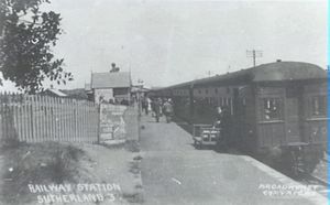
According to the official papers on the line's construction, when the line first opened for trains between Sydney and Sutherland construction was not quite complete, so excursion services initially ran on weekends only until the entire line was handed over. The first official train ran within the modern-day suburban area on December 9, 1885, although the line was closed once again between December 1885 and January 1886 to permit testing on the new bridge over the Georges River.[12]
Amplification and electrification
The line was originally constructed as double track between Illawarra Junction and Hurstville with single track thereafter; however, its rising use meant that the line required duplication soon afterwards. The line was duplicated between Hurstville and Loftus Station (then called Loftus Junction) (with the exception of the Como Bridge over the Georges River) in April 1890, then southward to Waterfall by 12 December of that year. The section of track between Illawarra Junction and Hurstville was quadruplicated between 1913 and 1925.[13]
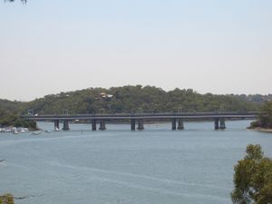
After duplication in 1890, the original Como Bridge, made of lattice girders, across the Georges River was laid as gauntlet track.[14] This arrangement remained in place for many decades, causing a notorious bottleneck on the line, until the New South Wales Government commissioned John Holland & Co. to build a new bridge in 1969. Construction of the new bridge, made of prestressed concrete box girders, commenced in 1969 and was first used by the 6.17pm service from Como on 19 November 1972.[15] The old bridge, as well as a former alignment of the line between Mortdale and Oatley replaced in 1905, is now used as a rail trail for pedestrians and cyclists.[16]
The Illawarra Line was the first railway electrified in New South Wales, and was built in conjunction with the construction of the "City Railway" between Central and St James Station, opening on 1 March, 1926, a few months before the line was connected to the new underground railway.[17][13] By November 1926, the electric overhead had passed Sutherland and continued to the branch line constructed to the Royal National Park.[13] The line between Loftus and Waterfall remained unelectrified until the 1980s and was serviced by steam and then diesel railcars. With the construction of the Eastern Suburbs Line in 1979, however, the Government decided to continue electrification to Wollongong, and the wires were extended to Waterfall on 20 July 1980 and on to Wollongong in 1984.[17][13]
Cronulla branch line
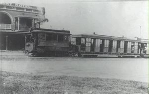
Transport in the Cronulla area had commenced after 1895, when a government subdivision between Gunnamatta Bay and Cronulla Beach had occurred, and a number of horse drawn omnibuses had commenced running between Sutherland Railway Station and the beach. A "Sutherland-Cronulla Tramway League" was formed towards the end of 1900, and they forwarded a petition to Parliament urging the construction of a tramway. The suggested route commenced at the southern end of Sutherland station, proceeded north-east to the Princes Highway, east along the Kingsway, then south past the site of the present rail terminus to Shelly Park in the centre of Cronulla. Approved by the Parliamentary Subcommittee on Public Works in 1908, the single track line, with four stations and a goods siding, was opened on June 12, 1911 at a cost of £37,505.[18]
Suggestions for a heavy rail line to the area were already being made in 1920, when Tom Uglys Bridge was being planned. The Under Secretary for Public Works suggested in 1923 that tramways at Kogarah or Hurstville could be extended to Cronulla to shorten the time of journey to and from Sydney. The Secretary for Railways responded that the tramway could be replaced with an electric railway. In the Secretary's view, an electric railway allowed "a direct service to be given with Sydney and intermediate stations ... [and] would serve the whole district more effectively than would be done by the extension of the tramway across the Georges River towards Cronulla." The Cronulla Chamber of Commerce agreed with the Secretary, suggesting that building a railway would save not only time, but also the cost of fares.[18]
By 1932 the Cronulla tramway had closed. Competing bus services had began to run with unrestricted competition, and the tram line by this time was so full with services that trams often ran late due to holdups at the crossing loops and passengers missed their connections at Sutherland. The line suffered large losses in its later years, and the effect of the Great Depression at the time forced it to cease its services, the last passenger service operating on August 3, 1931. The goods service continued until January 12 of the next year.[19]
Although the closure of the tramway allowed planning to go ahead for a railway, the planning for the replacement railway line suffered various delays in the 1930s due to funding issues: the line's construction competed with a proposal to electrify the Illawarra Line to Waterfall, and there were disputes over the point at which the line would connect to the main line. Two early proposals to join the line at Como and north of Sutherland Station were rejected.[20] Local residents were also concerned that the railway would increase Council rates in the Cronulla area.[21] Despite the delays, Parliament finally gave approval to the line on March 2, 1936, and a route with five new stations was surveyed which would connect with the main line at the Southern side of Sutherland station. The new line was opened on December 16, 1939[22] by the Governor, Baron Wakehurst at a large ceremony at Cronulla Station.[23]
Although a crossing loop was installed at Caringbah Station when the line was opened, the single track line prevented the expansion of services to the Cronulla peninsula, and so in the 1980s it was decided to duplicate a 3.5 km section of the line between Gymea and Caringbah, with Gymea. Miranda and Caringbah all receiving island platforms. The new section was opened on 15 July 1985.[24]
Other branch lines
Besides the main Cronulla branch, there have been several other branch lines connected from the Illawarra Line. The Bankstown Line was initially opened as a branch line from the Illawarra Line to Belmore Station in February 1895, although it was soon extended through to Sefton to the Main South Line on 16 July, 1928.[25] Similarly, the East Hills Line, now part of CityRail's Airport & East Hills Line since its connection with the Airport Line, was originally a branch line. First recommended to the Parliamentary Standing Committee on Public Works in 1916, as an alternate route when the Bankstown Line was being constructed,[26] the line opened to Kingsgrove on 21 September, 1931, and to East Hills three months later on 21 December, 1931.[27] It was connected to the Main South Line near Glenfield Railway Station on 21 December, 1987.[26]
Two other minor branch lines were also connected further south, to the Royal National Park and to the Woronora Cemetery, both of which have now closed to passenger trains.
Royal National Park branch
The large area of Crown Land now comprising the Royal National Park was gazetted as a National Park in 1879, only the second such area in the world.[28] In 1886 the need for a training ground for the New South Wales infantrymen, riflemen and artillery, prompted the construction of a short branch line into the National Park. It opened on 9 March, 1886 along with the extension of the Illawarra Line from Sutherland to Waterfall,[29] and first served passengers at an army camp open day around a month later. The station featured a single station, originally called "Loftus", with two terminal roads, several goods sidings and a loading bank to cope with the heavy artillery equipment.[19] A regular service to the Park, serving tourists commenced in May 1886, and a short section of the line was actually duplicated in 1899 to service the multiple trains that travelled there on weekends. When the Illawarra Line was electrified in 1926, this branch was included.[17][13]
Although the army camp closed after the Federation of Australia, the line continued to serve park visitors and residents of nearby Grays Point throughout the 20th Century. At one point in 1946, a second platform was added on the branch to serve the New South Wales State Scout Jamboree held between December 1946 and January 1947. The terminus station was renamed to "The Royal National Park" by June 1955, at the request of the Park's trustees.[19]
The opening of the Cronulla Branch, the building of more roads to the area and other factors led to a decline of services on the branch. Despite a resurgence of passengers in 1978, when the station was rebuilt following the relocation of the Park's Visitor's Centre to the site of the original station, patronage declined to approximately 3 passengers per train.[30] Up until 1990, the line continued to receive regular trains on weekends and was still featured as a branch line on the State Rail network.[31], but when passenger services were temporarily suspended in 1991 due to signalling problems on the branch, CityRail and the State Government decided to close the branch altogether, citing the lack of passengers. Although the branch lay dormant for some time, Parliamentary approval was subsequently given to the Sydney Tramway Museum to operate the line.[32] The Museum converted the branch to light rail standards in order to run their trams on it, and the line was reopened on 1 May 1993,[17] marketed as the ParkLink service. Trams now run on the branch on Sundays and public holidays at hourly intervals.[33]
Woronora Cemetery branch
In 1897, land was set aside near Sutherland Station for a denominational cemetery; it was an alternative to a site at Kurnell, which would have required a long branch line. A single track line 822 metres long was constructed next to the station and opened on 13 June, 1900.[34] A single platform 134.1m long and a loop for engines were included. The first funeral had taken place earlier that year, with the casket arriving by train from Mortuary Station in the city. Due to the advent of the motor car and motorised funerals, funerals by train became rare, and the line eventually closed on 23 May 1947, with no funeral having taken place for some years beforehand. The line and platform were subsequently demolished and removed, and no remains, apart from the original formation coming from the main line, are visible today.[19]
Eastern Suburbs Railway
- Further information: History of the Eastern Suburbs Railway
Proposals for a line to the Eastern Suburbs of Sydney had first been associated with demands in the 1860s that the railway be extended into Sydney's city, rather than terminating at the original Sydney station on the south of city. However, priorities in connecting country areas, and the high cost of a city railway meant that such plans were put aside. In the 1880s, the population of the Eastern Suburbs was small, and a railway would not have been viable.[35] Successive Royal Commissions in 1890 & 1896 recommended a railway be built into the city, with the provision for an Eastern Suburbs extension, but both requests were ignored.[36] Preference at the time, however, was for tramway construction: The Tramways Extension Bill 1880 was passed in 1880 and the tramway network in the Eastern Suburbs spread rapidly, reaching Bondi Beach in 1894, Rose Bay in 1898 and Watson's Bay in 1909.[37] Two other tram lines were also built to Randwick.
In 1916, a plan for the city railways, and an Eastern Suburbs extension was drawn up by the Chief Engineer of the Melbourne Railway Construction, Dr J. J. C. Bradfield. It was given subsequent approval by Parliament. Bradfield's plan entailed building a City Circle loop (as exists today), with an extension through to the Eastern Suburbs by means of a viaduct over Woolloomooloo. The line was to extend to Rosebery and Waterloo, with ten stations, linking with the Illawarra Line near Erskineville Station.[36]
Upon the passing of the City and Suburban Electric Railways (Amendment) Act in 1947, construction finally commenced on a variation of the Bradfield's proposal.[38] Two lines would be built: one proceeding on a viaduct out to Kings Cross, then eventually to Bondi Beach. Another line would head from St James Station via Taylor Square and the Sydney Cricket Ground, extending to Kingsford, with a proposal to extend from Taylor Square to Coogee. Construction commenced on sites around Central Station but ceased in 1952 due to a recession.[36] Work remained abandoned for over a decade.
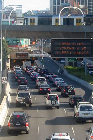
In 1967 construction again commenced on yet another variation on Bradfield's design. This involved the earlier route used towards Bondi Junction through Woolloomooloo, then an extension towards Kingsford with five extra stations at Charing Cross, Frenchmans Road, Randwick, University and Kingsford. The New South Wales Government awarded the contract for the civil and structural design to the successful Snowy Mountains Hydro-Electric Authority.[38] An official Legislative Assembly inquiry in 1976, however, recommended that costs on the project be cut, and the extension to Kingsford, a proposed station at Woollahra,[39] and the expansion of concourse areas at Bondi Junction and Martin Place stations did not proceed.[36] Nonetheless, it was resolved to fully integrate the railway with the Illawarra line. The Eastern Suburbs Railway opened between Central Station and Bondi Junction Station on 23 June, 1979. Initially trains ran as shuttle services between Central and Bondi Junction; it was not until a year later that work was finished to integrate the lines. A double-track junction with the Illawarra Line at Erskineville south of Illawarra Junction, twin single track tunnels connecting to the Eastern Suburbs Railway platforms at Central, a set of underground platforms at Redfern Station and a turnback tunnel at Martin Place Station opened to complete the project on 20 July, 1980.[40]
Bondi Junction Station had originally only been intended as an intermediate turnback station before the extension to Kingsford was abandoned. In 2001, the Carr Government rejected a proposed extension to Bondi Beach as a public-private partnership,[41], but pledged to increase the capacity of the turnback at the station as part of CityRail's Rail Clearways Program in 2004. As part of the $77 million "Bondi Junction Turnback" project, a new rail crossover was built between the single-track tunnels, enabling 20 trains an hour, up from 14, to use the station.[42][43] Services which ran from the Illawarra Line onto the City Circle were also transferred onto the Eastern Suburbs Line at this time. The work was completed in time for the introduction of the new CityRail timetable on 28 May, 2006.[44]
Operation
Trains
The Illawarra line carries mixed traffic of suburban, interurban and freight traffic. Freight traffic usually operates only to the junction with the Bankstown Line, and only passenger services now run on the Cronulla branch line and the Eastern Suburbs Railway. A large amount of coal and a lesser amount of other goods are transported by rail on the line daily, although freight trains are restricted from using the suburban lines during peak hours.[45]
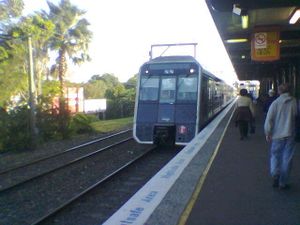
Historically, passenger service was provided to the Sydney Terminal (Central) by steam locomotives. The first services to Hurstville were run by steam locomotives of the Q.158 and R.285 classes.[46] When the City Underground opened to St James in 1926, a new electric service was provided to run there. From the time when the line to the Royal National Park was electrified, passengers received a steam train service at first, then when this became expensive, it was replaced by a rail motor service. This arrangement continued until the line was electrified to Waterfall, and the Eastern Suburbs Line was opened.[19] In 1979, the Eastern Suburbs Line being the first line to completely use double-decker rolling stock and started a gradual introduction of these trains onto the network.[4] The current running operations for passenger services have remained generally unchanged since 1981 with the integration of the Illawarra line and the Eastern Suburbs Railway. Suburban services utilise Erskineville Junction and proceed to Central and Bondi Junction.
Trains on the line almost exclusively use services provided by Mortdale Maintenance Depot,[47] so most services are run by L, S, T, & G sets.[48] Trains typically operate with 12 services per hour in peak, six services per hour in off-peak, and four per hour on weekends and public holidays.[49]
Stations
The line currently has 33 operating stations. Only three other stations or platforms have closed, being the two stations on the Royal National Park Branch (the main station, which closed in 1991 to trains, and the platform for the Scout's Camp, which closed in 1947), and the station on the Woronora Cemetery branch, which also closed in 1947.
| Name of Station | Code[50] | Distance from Central Station (km)[51] | Date of Opening[51] | TravelPass Zone[52] | Serving Suburbs | Connections |
| Eastern Suburbs & Illawarra Line | ||||||
|---|---|---|---|---|---|---|
| BJN | 6.757 | 23 June, 1979 | Red | Bondi Junction, Woollahra | ■South Coast Line (peak hour only) | |
| ECL | 4.823 | 23 June, 1979 | Red | Edgecliff, Darling Point | ■South Coast Line (peak hour only) | |
| KSX | 3.410 | 23 June, 1979 | Red | Kings Cross, Rushcutters Bay | ■South Coast Line (peak hour only) | |
| MPC | 2.102 | 23 June, 1979 | Red | Sydney CBD | ■South Coast Line (peak hour only) | |
| THL | 1.213 | 28 February, 1932[53] | Red | Sydney, Darling Harbour | ■Bankstown Line ■Inner West Line ■Airport & East Hills Line ■South Line, ■North Shore Line ■Northern Line ■South Coast Line (peak hour only) | |
| SBO | 0 | 28 February, 1932[53] | Red | Central, Strawberry Hills Ultimo, Surry Hills |
■Bankstown Line, ■Inner West Line, ■Airport & East Hills Line ■South Line, ■Western Line ■North Shore Line, ■Northern Line ■South Coast Line ■Southern Highlands Line (limited services only) ■Blue Mountains Line ■Newcastle & Central Coast Line | |
| RDF | 1.298[54] | 15 April, 1878[54] | Red | Redfern, Waterloo, Darlington The University of Sydney |
■Bankstown Line, ■Inner West Line, ■Airport & East Hills Line (peak hours only) ■South Line, ■Western Line ■Northern Line ■South Coast Line (peak hours only) ■Blue Mountains Line (peak hours only) ■Newcastle & Central Coast Line (peak hours only) | |
| SDN | 5.307 | 15 October, 1884 | Red | Sydenham, Marrickville | ■Bankstown Line ■Airport & East Hills Line (peak hours only) | |
| Tempe | TME | 6.841 | 16 October, 1884 | Red | Tempe, Undercliffe | |
| WOC | 7.300 | 21 May, 2000[55] | Red | Wolli Creek, Arncliffe | ■Airport & East Hills Line ■South Coast Line | |
| Arncliffe | ACL | 8.420 | 16 October, 1884 | Red | Arncliffe | |
| Banksia | BKA | 9.604 | 21 October, 1906 | Red | Banksia | |
| RKL | 10.405 | 15 October, 1884 | Red | Rockdale, Bexley | ||
| KGH | 11.607 | 15 October, 1884 | Green | Kogarah | ||
| Carlton | CLJ | 12.741 | 1 January, 1887 | Yellow | Carlton | |
| Allawah | AWH | 13.691 | 15 November, 1925 | Yellow | Allawah | |
| HVL | 14.837 | 15 October, 1884 | Yellow | Hurstville | ■South Coast Line | |
| PHS | 16.124 | 1886[56] | Yellow | Penshurst | ||
| MDE | 17.055 | 20 March, 1897 | Yellow | Mortdale | ||
| Oatley | OAL | 18.281 | 1886[56] | Yellow | Oatley | |
| Como | CMO | 21.237 | 26 December, 1885 | Yellow | Como, Como West | |
| Jannali | JNL | 22.218 | 7 September, 1931 | Yellow | Jannali | |
| SLD | 24.460 | 26 December, 1885 | Pink | Sutherland | ■South Coast Line | |
| LOF | 26.288 | 9 March, 1886 | Pink | Loftus | ||
| EGD | 30.752 | 1 October, 1920 | Pink | Engadine | ||
| HTC | 33.152 | 9 March, 1886 | Purple | Heathcote | ||
| WFL | 38.740 | 9 March, 1886 | Purple | Waterfall | ■South Coast Line (some services) | |
| Cronulla Line (splits at Sutherland) | ||||||
| KEE | 26.636 | 16 December, 1939 | Pink | Kirrawee | ||
| GYM | 27.944 | 16 December, 1939 | Pink | Gymea | ||
| MIJ | 29.508 | 16 December, 1939 | Pink | Miranda | ||
| CIH | 31.509 | 16 December, 1939 | Pink | Caringbah | ||
| WOE | 33.601 | 16 December, 1939 | Purple | Woolooware | ||
| CNL | 34.807 | 16 December, 1939 | Purple | Cronulla | Cronulla-Bundeena Ferry | |
Stopping patterns
The stopping patterns on the Eastern Suburbs & Illawarra Line have generally centred around several different termini. The steam era saw these termini change quite frequently as more terminating facilities were constructed: the first trains on the line after the Waterfall extension in 1887 either ran to Hurstville (16 per day), Sutherland (2 per day) and Waterfall (2 per day), with all trains stopping at every intermediate station. By 1907, however, Como and Oatley had been added to the list of termini, with nine and seven trains per day respectively. Seven trains per day at this time also ran to Sutherland, and one to Waterfall. Most trains terminated at Hurstville.[19]
Since electrification, the terminus stations for suburban trains have remained consistent. From 1926 trains terminated at either Hurstville, Sutherland and The National Park. With the opening of the Cronulla branch in 1939, Cronulla become the forth major terminus. In 1980 Waterfall was electrified and replaced The Royal National Park as a terminus, having been served by a diesel-operated shuttle service until that time.[19]
Today, the Eastern Suburbs & Illawarra line generally operates with five termini at Hurstville, Mortdale, Sutherland, Cronulla, and Waterfall. The vast majority of trains operate to the terminal at Bondi Junction, mostly using the following patterns:[57]
- On weekdays, trains to and from Waterfall generally stop at all stations to Hurstville, then Kogarah, Rockdale, Wolli Creek, Sydenham, all stations to Bondi Junction and vice-versa. Late night and weekend trains stop at all stations on the main line.[58]
- Trains to and from Cronulla generally stop at all stations on the branch, then Sutherland, Jannali, Mortdale, Penshurst, Hurstville, Kogarah, Rockdale, Wolli Creek, Sydenham, Redfern and all stations to Bondi Junction.[59]
- Trains only terminate at Sutherland during the week, typically stopping at all stations but Oatley, Como, and Jannali.[60]
- Some inbound trains begin at Mortdale, typically stopping at all stations.[61]
- Trains only terminate at Hurstville during the week, typically stopping at all stations.[62]
Since the opening of the Bondi Junction Turnback project in 2006, all trains on the line have stopped at all stations on the Eastern Suburbs Line.[49]
Future
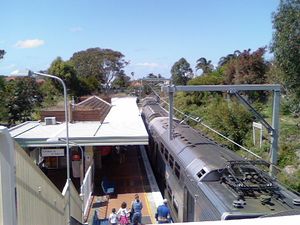
Unlike some areas of the CityRail network which have continued to suffer problems, it is believed that many of the problems of overcrowding and late trains experienced as recently as 2004[63] have largely eased on the line since the introduction of a new timetable in May 2006.[64] However, the lack of rail services (combined with recent cuts to services)[65] and resultant capacity problems on the line continue to be a problem; many commuters have been upset by the crowded trains.[66] Experts too have recognised a need to expand capacity on the Eastern Suburbs Line; a 2002 report by former CityRail chairman Ron Christie noted that capacity on Illawarra Line trains was often at 120%, and that 180% was not unexpected.[67]
State Plan and future infrastructure
The New South Wales State Government has introduced a State Plan for its 2007 election campaign which includes transport infrastructure projects up to the year 2017. Many of the projects on the Plan are for other lines, however, the Illawarra Line has received several projects to upgrade its capacity. The most notable of these, and one that has been under planning since 2005 as part of CityRail's Clearways Program, has been an upgrade to the Cronulla Line. At present, the line's single track setup enables only four trains an hour to use the branch. Under the plans, the entire line will be converted to double track, with new platforms at Kirrawee and Woolooware Stations, and Cronulla station refigured to stable more trains. This project will enable six trains an hour to use the branch and will allow capacity on the line to increase over the next decade.[68] Planning approval for the project was given on 4 December 2006.[69]
Apart from the Cronulla Line upgrade, it is proposed that by 2017, the line capacity between Hurstville and Sutherland will be amplified to allow the extra services to and from Cronulla, as well as for services accessing the Mortdale Maintenance Centre.[70] Carlton, Rockdale and Penshurst Stations will all receive Easy Access upgrades, and the line between Oatley, Sutherland and Cronulla will receive signalling upgrades to allow more services to run at shorter intervals.[71] The State Opposition labelled the Plan and its promises nothing more than an "election stunt".[72] They have preferred to focus more on the expansion of Sydney's light rail to the inner city suburbs as a solution to capacity problems on Sydney's train network.[73]
Christie Report and other proposals
In 2002, former CityRail chairman released a report, the "Long-term strategic plan for rail", which outlined the critical infrastructure that would need to be built between then and 2050 to ensure the long-term survival and operation of the CityRail network. The report higlighted the problems facing the network at that time, and Christie noted that by 2011, the capacity of the Illawarra Line would be severely constrained, and that there would be no capacity on the Eastern Suburbs Line for trains coming from the Illawarra Line.[74]
Christie's report suggested that several "metro" lines should be built to service new areas and to relieve capacity on existing lines. These included a metro line to supplement the Illawarra Line: Christie suggested a line extending from Cronulla to Miranda along the existing tracks, then along a reserved corridor for the F6 Southern Freeway up to Sydney Airport. The line would then extend to the Sydney CBD then to Sydney's Northern Beaches via Chatswood. Christie suggested that even if the entire line were not to be built, the first stage between Cronulla, the Airport and the City would provide "essential capacity relief" for the Illawarra line which would be "severely capacity-constrained" within two decades. Both heavy rail and light rail were mooted as transport suggestions.[75]
Christie was not the only person to suggest the F6 Corridor as an alternative. In 2002, former Minister for Transport Carl Scully officially abandoned the corridor, reserved since 1951 for the extension of the Southern Freeway north to St Peters, and suggested that light rail, bus-only roads or high-frequency train services could run on the corridor. He wished to encourage innovative public transport solutions in the area, while maintaining the green space available near Botany Bay.[76] The plan received support from environmental groups, with environmental transport group EcoTransit proposing their own 25.5 km light rail line to supplement the Illawarra Line on the reservation, called the "Bay Light Express".[77] Since 2005, however, the future of an alternative corridor has been in doubt, with State Treasurer Michael Costa announcing that the corridor would again be reserved for a motorway;[78] however metro lines remain on the Government's agenda for the future and a rapid transit line supplementing the Illawarra Line may be possible in the future.[79]
See also
Operators and companies connected to the line
- CityRail - operator of services on the line.
- Transport Infrastructure Development Corporation - State-owned corporation constructing the upgrade to the Cronulla Line.
Other railways in the area
- South Coast Line - connects to the line at its southern end.
- Trams in Sydney - details on other tramway services in the Southern Suburbs of Sydney in the 19th and early 20th centuries.
General articles on railways in Sydney
- List of Sydney railway stations
- Railways in Sydney
- Rail transport in New South Wales
- Sydney underground railways - other underground lines in Sydney
Notes
- ↑ Michael Costa MLC, "Address to the State Chamber of Commerce Luncheon", August 21, 2003. Accessed 12 January, 2007.
- ↑ Fulton, Adam, "Rail users happy with Illawarra", Sydney Morning Herald, 11 May, 1989, p. 4.
- ↑ Rail Corporation New South Wales, "CityRail: CityRail Network Maps", Accessed 10 January, 2007.
- ↑ 4.0 4.1 4.2 Public Transport Commission of New South Wales (1979), The story of the Eastern Suburbs Railway. Public Transport Commission of New South Wales: Sydney, p. 13.
- ↑ 5.0 5.1 Rail Corporation New South Wales, Illawarra Line Track Diagram. Accessed 9 September, 2002.
- ↑ Forsyth, J.H. (ed.) (1988-93), Stations & Tracks; Vol. 1: "Main Suburban & Branches -- Illawarra & Branches". State Rail Authority of New South Wales: Sydney, pp. 169–70.
- ↑ 7.0 7.1 Letter from Mr R. Stephens, Surveyor, to Mr John Whitton, Engineer-in-Chief, New South Wales Railways, April 20, 1874. Cited in Forsyth, J.H. (ed.) (1988-93), Stations & Tracks; Vol. 1: "Main Suburban & Branches -- Illawarra & Branches". State Rail Authority of New South Wales: Sydney, pp. 169–70.
- ↑ 8.0 8.1 Forsyth, J.H. (ed.) (1988-93), Stations & Tracks; Vol. 1: "Main Suburban & Branches -- Illawarra & Branches". State Rail Authority of New South Wales: Sydney, p. 171.
- ↑ Bozier, Rolfe, "South Coast Line". Accessed 25 January, 2007.
- ↑ 10.0 10.1 Forsyth, J.H. (ed.) (1988-93), Stations & Tracks; Vol. 1: "Main Suburban & Branches -- Illawarra & Branches". State Rail Authority of New South Wales: Sydney, p. 172.
- ↑ Bozier, Rolfe, "New South Wales Railways: Waterfall Railway Station". Accessed 11 January, 2007.
- ↑ Forsyth, J.H. (ed.) (1988-93), Stations & Tracks; Vol. 1: "Main Suburban & Branches -- Illawarra & Branches". State Rail Authority of New South Wales: Sydney, p. 172.
- ↑ 13.0 13.1 13.2 13.3 13.4 Forsyth, J.H. (ed.) (1988-93), Stations & Tracks; Vol. 1: "Main Suburban & Branches -- Illawarra & Branches". State Rail Authority of New South Wales: Sydney, p. 100.
- ↑ Dewick, Craig, "Railzone FAQ#2: What is gauntlet track?". Accessed 11 January, 2007.
- ↑ Forsyth, J.H. (ed.) (1988-93), Stations & Tracks; Vol. 1: "Main Suburban & Branches -- Illawarra & Branches". State Rail Authority of New South Wales: Sydney, p. 121.
- ↑ "RailTrails Australia: Como Railway Bridge - Trail Description". Accessed 11 January, 2007.
- ↑ 17.0 17.1 17.2 17.3 Lukaszyk, Anita, "Neety's Train Page - Electrification" (Table sourced from Historic Electric Traction). Railpage Australia: Melbourne. Accessed 11 January, 2007.
- ↑ 18.0 18.1 Forsyth, J.H. (ed.) (1988-93), Stations & Tracks; Vol. 1: "Main Suburban & Branches -- Illawarra & Branches". State Rail Authority of New South Wales: Sydney, pp. 208–10.
- ↑ 19.0 19.1 19.2 19.3 19.4 19.5 19.6 Neve, Peter (1997), "Railways (and tramways) in the Sutherland Shire": (Sutherland Shire Studies No. 6), Sutherland Shire Council. Accessed 11 January, 2007.
- ↑ Forsyth, J.H. (ed.) (1988-93), Stations & Tracks; Vol. 1: "Main Suburban & Branches -- Illawarra & Branches". State Rail Authority of New South Wales: Sydney, p. 211.
- ↑ Forsyth, J.H. (ed.) (1988-93), Stations & Tracks; Vol. 1: "Main Suburban & Branches -- Illawarra & Branches". State Rail Authority of New South Wales: Sydney, p. 214.
- ↑ Bozier, Rolfe, "New South Wales Railways: Cronulla Line: History". Accessed 11 January, 2007.
- ↑ Forsyth, J.H. (ed.) (1988-93), Stations & Tracks; Vol. 1: "Main Suburban & Branches -- Illawarra & Branches". State Rail Authority of New South Wales: Sydney, p. 216.
- ↑ Forsyth, J.H. (ed.) (1988-93), Stations & Tracks; Vol. 1: "Main Suburban & Branches -- Illawarra & Branches". State Rail Authority of New South Wales: Sydney, p. 206.
- ↑ Forsyth, J.H. (ed.) (1988-93), Stations & Tracks; Vol. 1: "Main Suburban & Branches -- Illawarra & Branches". State Rail Authority of New South Wales: Sydney, p. 177.
- ↑ 26.0 26.1 Forsyth, J.H. (ed.) (1988-93), Stations & Tracks; Vol. 1: "Main Suburban & Branches -- Illawarra & Branches". State Rail Authority of New South Wales: Sydney, p. 195.
- ↑ Bozier, Rolfe, "New South Wales Railways: East Hills Line: History". Accessed 11 January, 2007.
- ↑ New South Wales National Parks & Wildlife Service, "Parks & Reserves: Royal National Park". Accessed 21 January, 2007.
- ↑ Bozier, Rolfe, "New South Wales Railways: Royal National Park Branch: Description". Accessed 11 January, 2007.
- ↑ Bozier, Rolfe, "New South Wales Railways: Royal National Park Branch: Description". Accessed 11 January, 2007.
- ↑ State Rail Authority of New South Wales, Sutherland Timetable, commencing 29 April 1991, cited in "NSW Rail Historical Timetables: CityRail". Accessed 30 December, 2006.
- ↑ Christopher Downy MLA, Private Members Statements, “Sydney Tramway Museum”: New South Wales Legislative Assembly: Hansard, 25 February 1992, Article 25. Accessed 11 January, 2007.
- ↑ Sydney Tramway Museum, "Our Vintage Tram Routes", Railpage Australia: Melbourne. Accessed 11 January, 2007.
- ↑ Forsyth, J.H. (ed.) (1988-93), Stations & Tracks; Vol. 1: "Main Suburban & Branches -- Illawarra & Branches". State Rail Authority of New South Wales: Sydney, p. 125.
- ↑ Public Transport Commission of New South Wales (1979), The story of the Eastern Suburbs Railway. Public Transport Commission of New South Wales: Sydney, p. 4.
- ↑ 36.0 36.1 36.2 36.3 Public Transport Commission of New South Wales (1979), The story of the Eastern Suburbs Railway. Public Transport Commission of New South Wales: Sydney, pp. 5–6.
- ↑ Keenan, D. (1979), Tramways of Sydney. Transit Press: Sydney, p. 2
- ↑ 38.0 38.1 "Australasian Tunnelling Society: Eastern Suburbs Railway, Sydney". Accessed 11 January, 2007.
- ↑ "Trendy's Train Page: Woollahra Station". Accessed 11 January 2007.
- ↑ Forsyth, J.H. (ed.) (1988-93), Stations & Tracks; Vol. 1: "Main Suburban & Branches -- Illawarra & Branches". State Rail Authority of New South Wales: Sydney, p. 42.
- ↑ Carl Scully MLA, "Media Release: Bondi Beach Rail Link", New South Wales Government, 21 May 2001 (PANDORA Archive). Accessed 10 January, 2007.
- ↑ Transport Infrastructure Development Corporation, "Bondi Junction Turnback: Project Profile". Accessed 11 January, 2007.
- ↑ "Bondi rail project 'to boost efficiency'", Sydney Morning Herald, April 17, 2006. Accessed 11 January, 2007.
- ↑ Transport Infrastructure Development Corporation, "Media Release: Bondi Junction Clearways Project Completed", 1 May 2006. Accessed 11 January, 2007.
- ↑ Australian Rail Track Corporation, "Southern Sydney Freight Line: Index". Accessed 11 January, 2007.
- ↑ Forsyth, J.H. (ed.) (1988-93), Stations & Tracks; Vol. 1: "Main Suburban & Branches -- Illawarra & Branches". State Rail Authority of New South Wales: Sydney, p. 174.
- ↑ Gee, Steve & Downie, Stephen, "Train breakdown hits peak hour", Daily Telegraph (Sydney), 14 August 2000, p. 3.
- ↑ Rail Corporation New South Wales, CityRail's Fleet, Accessed 11 January 2007.
- ↑ 49.0 49.1 Rail Corporation New South Wales, "CityRail Timetables: Eastern Suburbs & Illawarra Line". Accessed 11 January, 2007.
- ↑ Bozier, Rolfe, "New South Wales Railways: NSW Station Codes". Accessed June 19, 2002.
- ↑ 51.0 51.1 Sourced from Forsyth, J.H. (ed.) (1988-93), Stations & Tracks; Vol. 1: "Main Suburban & Branches -- Illawarra & Branches". State Rail Authority of New South Wales: Sydney, pp. 42–44, 101–128, 206–208 passim, except where noted.
- ↑ Transport InfoLine, "Fares & Passes: Travelpass: CityRail Map". Accessed 30 December, 2006.
- ↑ 53.0 53.1 The Eastern Suburbs Railway platforms for Town Hall and Central stations opened 23 June, 1979. Cited in Forsyth, J.H. (ed.) (1988-93), Stations & Tracks; Vol. 1: "Main Suburban & Branches -- Illawarra & Branches". State Rail Authority of New South Wales: Sydney, pp. 42–43.
- ↑ 54.0 54.1 The Eastern Suburbs Railway platforms at Redfern opened 20 July, 1980. These platforms are located at 1.318km from Central. Cited in Forsyth, J.H. (ed.) (1988-93), Stations & Tracks; Vol. 1: "Main Suburban & Branches -- Illawarra & Branches". State Rail Authority of New South Wales: Sydney, p. 42.
- ↑ Bozier, Rolfe, "New South Wales Railways: Airport Line: History". Accessed 24 January, 2007.
- ↑ 56.0 56.1 The official records do not give a specific date of opening for Penshurst or Oatley stations; only a year. Cited in Forsyth, J.H. (ed.) (1988-93), Stations & Tracks; Vol. 1: "Main Suburban & Branches -- Illawarra & Branches". State Rail Authority of New South Wales: Sydney, pp. 118 & 120.
- ↑ Sourced from Rail Corporation New South Wales, "CityRail - The Timetable; accessed 28 January, 2007.
- ↑ Of the 47 outbound and 47 inbound weekday Waterfall trains, 33 outbound and 33 inbound (70%) follow this pattern. All weekday trains after 9 P.M. and all weekend trains make all stops.
- ↑ 37 of 53 weekday outbound, 39 of 41 weekend outbound, 35 of 52 weekday inbound, and 39 of 39 weekend inbound Cronulla trains (81%) follow this pattern.
- ↑ Of the 14 outbound and 16 inbound weekday Sutherland trains, 10 outbound and 11 inbound (70%) follow this pattern.
- ↑ Of the 12 weekday and 1 weekend inbound Mortdale trains, 8 weekday and 1 weekend (69%) run completely local.
- ↑ Of the 33 outbound and 20 inbound weekday Hurstville trains, 26 outbound and 20 inbound (87%) run completely local.
- ↑ Dick, Tim & Smith, Alexandra, "Pique hour leaves commuters hot and bothered", Sydney Morning Herald, February 11, 2004. Accessed 11 January, 2007.
- ↑ Australian Associated Press, "Trains running on time for timetable day two", September 6, 2005. Accessed 11 January 2007.
- ↑ Smith, Alexandra, "Costa's time warp: fewer, slower services", Sydney Morning Herald, 12 May 2004. Accessed 11 January, 2007.
- ↑ Levy, Megan, "Fed up with rail services", Illawarra Mercury, 28 October 2006, p. 5.
- ↑ Goodsir, Darren & Kerr, Joseph, "Exposed: Fast Track To Rail Chaos", Sydney Morning Herald, 25 February 2002, p. 1.
- ↑ Transport Infrastructure Development Corporation, "Cronulla Line Duplication: Project Profile". Accessed 12 January, 2007.
- ↑ Transport Infrastructure Development Corporation, "Cronulla Duplication: Planning Approval". Accessed 12 January, 2007.
- ↑ Ron Christie's report had proposed this in 2002. See Christie, Ron, "Long-term strategic plan for rail: overview report: Greater Sydney metropolitan region" - Chapter 4.4, Action for Public Transport New South Wales, June 2001. Accessed 11 January 2007.
- ↑ New South Wales State Government, "New South Wales State Plan", 2006, Appendix, pp. 2, 3 & 5. Accessed 30 December, 2006.
- ↑ Pearlman, Jonothan, "Hard sell: Iemma's $2.6m campaign to spruik State Plan", Sydney Morning Herald, 15 November 2006. Accessed 11 January, 2007.
- ↑ Liberal Party of Australia, "Fixing Public Transport: Expanding Light Rail in Sydney and NSW". Accessed 21 January, 2007.
- ↑ Christie, Ron, "Long-term strategic plan for rail: overview report: Greater Sydney metropolitan region" - Chapter 4.4, Action for Public Transport New South Wales, June 2001. Accessed 11 January, 2007.
- ↑ Christie, Ron, "Long-term strategic plan for rail: overview report: Greater Sydney metropolitan region" - Chapter 5, Action for Public Transport New South Wales, June 2001. Accessed 11 January, 2007.
- ↑ Goodsir, Darren, "Buses, light rail replace freeway plan", Sydney Morning Herald, September 7, 2002. Accessed 12 January, 2007.
- ↑ EcoTransit, Bay Light Express: Bay Light West". Accessed February 1, 2003.
- ↑ Smith, Alexandra, "Scully buried it, now Costa resurrects F6", Sydney Morning Herald, March 16, 2005. Accessed January 13, 2007.
- ↑ New South Wales Government, "Urban Transport Statement 2006: Metro lines: part of Sydney's transport future?". Accessed 12 January, 2007.
References
Books and articles
- Keenan, D.R. (1979), Tramways in Sydney, Sydney: Transit Press, ISBN 0909338027
- Neve, P. (1997), Railways (and tramways) in the Sutherland Shire (Sutherland Shire Studies No. 6), Sutherland Shire Council [link accessed 11 January, 2007]
- New South Wales Public Transport Commission (1979), The story of the Eastern Suburbs Railway, Sydney: New South Wales Public Transport Commission, ISBN : None (Privately published)
- Forsyth, J.H. (ed.) (1988–93), Stations & Tracks: Vol. 1: Main Suburban & Branches, Illawarra & Branches, Sydney: State Rail Authority of New South Wales, Archive Section, ISBN : None (Privately published)
Web sites
- Bozier, Rolfe (December 1999). New South Wales Railways:South Coast Line. Retrieved on 2007-01-12. - information, pictures and data on the Eastern Suburbs & Illawarra Line.
- Christie, Ron (June 2001). Long-term Strategic Plan for Rail: Greater Sydney metropolitan region. Government of New South Wales. Retrieved on 2007-01-12.
External links
- CityRail Timetables: Illawarra Line - timetables for the line.
- Neety's Train Page: ESR/Illawarra Line: Names and Meanings - meanings of station names on the line, and photos of stations.
- New South Wales Government State Plan
- Public Transport Ticketing - includes pictures of the original tickets sold on the Eastern Suburbs Line in 1979.
- Railpix Australia - Quality Rail images: The Illawarra Line
