File:Irl-TraleeDingleRailViaduct.jpg
From TrainSpottingWorld, for Rail fans everywhere
No higher resolution available.
Irl-TraleeDingleRailViaduct.jpg (640 × 480 pixels, file size: 141 KB, MIME type: image/jpeg)
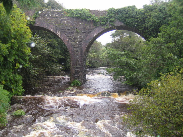
Summary: Finglas River and disused railway viaduct viewed looking upstream from Curraduff Bridge on the N86 road to Dingle, this is the Finglas River in spate after a night of heavy rain. The viaduct carried the former Tralee and Dingle Light Railway over the river. The railway closed in 1953.
File history
Click on a date/time to view the file as it appeared at that time.
| Date/Time | Thumbnail | Dimensions | User | Comment | |
|---|---|---|---|---|---|
| current | 01:23, 16 February 2007 | | 640 × 480 (141 KB) | Admin (talk | contribs) | Summary: Finglas River and disused railway viaduct viewed looking upstream from Curraduff Bridge on the N86 road to Dingle, this is the Finglas River in spate after a night of heavy rain. The viaduct carried the former Tralee and Dingle Light Railway over the river. The railway closed in 1953. {{geograph| 256259|Nigel Cox}} |
- You cannot overwrite this file.
File usage
The following page links to this file:
