Category:Railway maps of United Kingdom
From TrainSpottingWorld, for Rail fans everywhere
Media in category "Railway maps of United Kingdom"
The following 7 files are in this category, out of 7 total.
- British Rail Borderlands Line diagram with interconnections.png 1,576 × 1,576; 150 KB
- British Rail York to Leeds via Harrogate diagram map.png 785 × 1,607; 95 KB
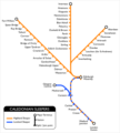
- Calsleep.png 325 × 361; 13 KB
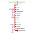
- Merseyrail Northern Line.png 600 × 836; 71 KB
- Merseyrail Wirral Line.png 742 × 1,066; 98 KB
- Steeple Grange Light Railway plan.png 600 × 250; 7 KB


