File:WBA rail map.jpg
From TrainSpottingWorld, for Rail fans everywhere
Size of this preview: 480 × 480 pixels. Other resolutions: 240 × 240 pixels | 800 × 800 pixels.
Original file (800 × 800 pixels, file size: 59 KB, MIME type: image/jpeg)
Summary
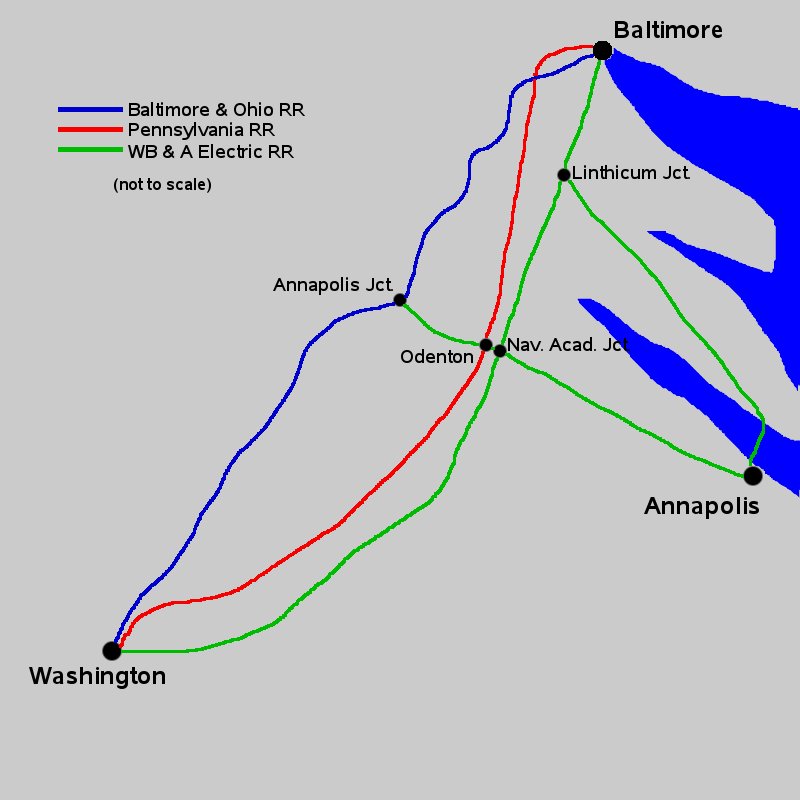
Map showing Washington, Baltimore, and Annapolis rail connections at the height of interurban rail transit (early 20th century).
Licensing

I, the creator of this work, hereby grant the permission to copy, distribute and/or modify this document under the terms of the GNU Free Documentation License, Version 1.2 or any later version published by the Free Software Foundation; with no Invariant Sections, no Front-Cover Texts, and no Back-Cover Texts.
Subject to disclaimers.
File history
Click on a date/time to view the file as it appeared at that time.
| Date/Time | Thumbnail | Dimensions | User | Comment | |
|---|---|---|---|---|---|
| current | 02:28, 16 February 2007 | | 800 × 800 (59 KB) | Admin (talk | contribs) | == Summary == Map showing Washington, Baltimore, and Annapolis rail connections at the height of interurban rail transit (early 20th century). == Licensing == {{GFDL-self}} |
- You cannot overwrite this file.
File usage
The following 3 pages link to this file:
