File:SuperContinental RouteMap.png
From TrainSpottingWorld, for Rail fans everywhere

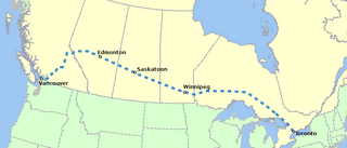
Size of this preview: 640 × 273 pixels. Other resolutions: 320 × 137 pixels | 864 × 369 pixels.
Original file (864 × 369 pixels, file size: 59 KB, MIME type: image/png)
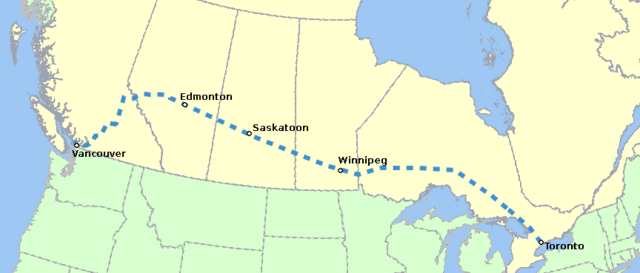
Route map of the en:Super Continental passenger train.
Created by en:User:Al guy on March 5, 2005 and released under the GFDL. Map drawn in en:GIMP. Underlying data is public domain courtesy of United States Bureau of Transportation Statistics [1]. See en:User:Al guy/maps for general information on how the map was created.

Permission is granted to copy, distribute and/or modify this document under the terms of the GNU Free Documentation License, Version 1.2 or any later version published by the Free Software Foundation; with no Invariant Sections, no Front-Cover Texts, and no Back-Cover Texts.
Subject to disclaimers.
File history
Click on a date/time to view the file as it appeared at that time.
| Date/Time | Thumbnail | Dimensions | User | Comment | |
|---|---|---|---|---|---|
| current | 22:39, 15 February 2007 | | 864 × 369 (59 KB) | Admin (talk | contribs) | Route map of the en:Super Continental passenger train. Created by en:User:Al guy on March 5, 2005 and released under the GFDL. Map drawn in en:GIMP. Underlying data is public domain courtesy of United States Bureau of Transportation Statistics [http://www.bts.gov/publications/north_american_transportation_atlas_data/]. See en:User:Al guy/maps for general information on how the map was created. {{GFDL}} Category:Historical maps of Canada Category:Railroad maps of Canada |
- You cannot overwrite this file.
File usage
The following page links to this file:
