File:North yorkshire moors railway map.gif
From TrainSpottingWorld, for Rail fans everywhere
Size of this preview: 640 × 410 pixels. Other resolutions: 320 × 205 pixels | 921 × 590 pixels.
Original file (921 × 590 pixels, file size: 25 KB, MIME type: image/gif)
Summary
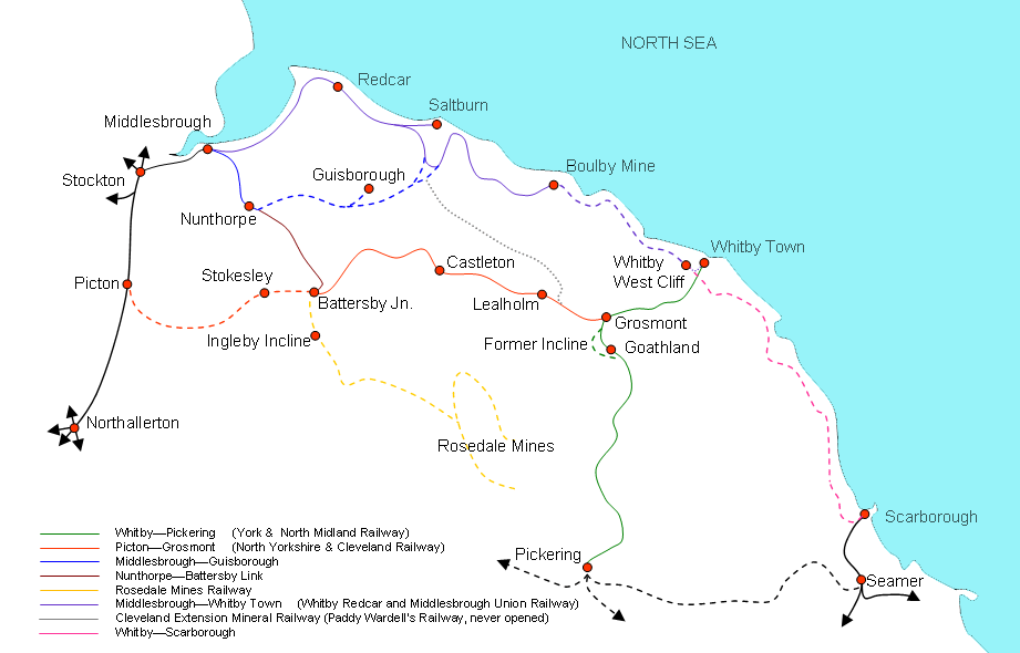
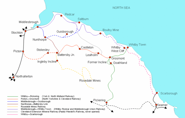
Map of former and existing railway lines across the North Yorkshire Moors, Mat Overton, 2006
Licensing
 Permission is granted to copy, distribute and/or modify this document under the terms of the GNU Free Documentation License, Version 1.2 or any later version published by the Free Software Foundation; with no Invariant Sections, no Front-Cover Texts, and no Back-Cover Texts.
|
File history
Click on a date/time to view the file as it appeared at that time.
| Date/Time | Thumbnail | Dimensions | User | Comment | |
|---|---|---|---|---|---|
| current | 06:40, 16 February 2007 | | 921 × 590 (25 KB) | Admin (talk | contribs) | == Summary == Map of former and existing railway lines across the North Yorkshire Moors, Mat Overton, 2006 == Licensing == {{self2|GFDL|cc-by-2.5}} |
- You cannot overwrite this file.
File usage
The following 2 pages link to this file:
