File:NSSR Map.png
From TrainSpottingWorld, for Rail fans everywhere
No higher resolution available.
NSSR_Map.png (536 × 368 pixels, file size: 50 KB, MIME type: image/png)
Summary
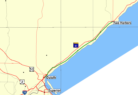
Map of the North Shore Scenic Railroad between Duluth, Minnesota and Two Harbors, Minnesota. Base image from the National Atlas; road signs from existing Wikipedia GFDL images; remainder self-drawn.
Licensing
 Permission is granted to copy, distribute and/or modify this document under the terms of the GNU Free Documentation License, Version 1.2 or any later version published by the Free Software Foundation; with no Invariant Sections, no Front-Cover Texts, and no Back-Cover Texts.
|
File history
Click on a date/time to view the file as it appeared at that time.
| Date/Time | Thumbnail | Dimensions | User | Comment | |
|---|---|---|---|---|---|
| current | 23:38, 15 February 2007 | | 536 × 368 (50 KB) | Admin (talk | contribs) | == Summary == Map of the North Shore Scenic Railroad between Duluth, Minnesota and Two Harbors, Minnesota. Base image from the National Atlas; road signs from existing Wikipedia GFDL images; remainder self-drawn. == Licensing == {{self2|GFDL|cc-by-sa-2.5,2.0,1.0}} |
- You cannot overwrite this file.
File usage
The following 2 pages link to this file:
