File:Indian pacific map.gif
From TrainSpottingWorld, for Rail fans everywhere
No higher resolution available.
Indian_pacific_map.gif (503 × 396 pixels, file size: 11 KB, MIME type: image/gif)
Summary
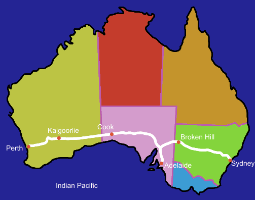
Route map of Indian Pacific in Australia shown in white. I made the map.
The places shown are where the train stops where there is enough time to look around (about 3 hours in Kalgoorlie, Adelaide & Broken Hill and 1 hour in Cook)
Licensing
 Permission is granted to copy, distribute and/or modify this document under the terms of the GNU Free Documentation License, Version 1.2 or any later version published by the Free Software Foundation; with no Invariant Sections, no Front-Cover Texts, and no Back-Cover Texts.
|
[[]]
File history
Click on a date/time to view the file as it appeared at that time.
| Date/Time | Thumbnail | Dimensions | User | Comment | |
|---|---|---|---|---|---|
| current | 22:08, 15 February 2007 | | 503 × 396 (11 KB) | Admin (talk | contribs) | == Summary == Route map of Indian Pacific in Australia shown in white. I made the map. The places shown are where the train stops where there is enough time to look around (about 3 hours in Kalgoorlie, Adelaide & Broken Hill and 1 hour in Cook) == Licensing == {{self2|GFDL|cc-by-sa-2.5,2.0,1.0}} [[[[Category:Indian Pacific]]]] |
- You cannot overwrite this file.
File usage
The following 2 pages link to this file:
