File:Glarner Sprinter Map.Full.png
From TrainSpottingWorld, for Rail fans everywhere
No higher resolution available.
Glarner_Sprinter_Map.Full.png (294 × 291 pixels, file size: 51 KB, MIME type: image/png)
Summary
| Description |
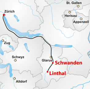
Map of the Glarner Sprinter train route (complete) |
|---|---|
| Source |
Own work, based on [1] |
| Date |
2006-12-14 |
| Author |
Cacetudo |
| Permission (Reusing this image) |
See license |
Licensing
 Permission is granted to copy, distribute and/or modify this document under the terms of the GNU Free Documentation License, Version 1.2 or any later version published by the Free Software Foundation; with no Invariant Sections, no Front-Cover Texts, and no Back-Cover Texts. |
File history
Click on a date/time to view the file as it appeared at that time.
| Date/Time | Thumbnail | Dimensions | User | Comment | |
|---|---|---|---|---|---|
| current | 22:42, 15 February 2007 | | 294 × 291 (51 KB) | Admin (talk | contribs) | == Summary == {{Information |Description=Map of the Glarner Sprinter train route (complete) |Source=Own work, based on [http://commons.wikimedia.org/wiki/Image:Karte_Schweiz.png] |Date=2006-12-14 |Author=Cacetudo |Permission=See license }} == Licensing == {{self|GFDL}} Category:Maps of the canton of Zürich Category:Canton of Schwyz Category:Maps of the canton of Glarus Category:SBB-CFF-FFS Category:Railroad maps of Switzerland |
- You cannot overwrite this file.
File usage
The following page links to this file:

![[1]](http://commons.wikimedia.org/wiki/Image:Karte_Schweiz.png)