File:Udmap.jpg
From TrainSpottingWorld, for Rail fans everywhere
Size of this preview: 456 × 479 pixels. Other resolutions: 228 × 240 pixels | 780 × 820 pixels.
Original file (780 × 820 pixels, file size: 151 KB, MIME type: image/jpeg)
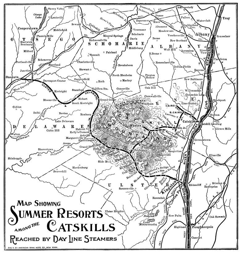
A map of the railroads in the Catskill Mountains. Despite what the map says, nearly the entirity of this map is of the Catskills. East of the Hudson River are The Berkshires and the Taconic Mountains, and to the far north (central and northern Albany County, and far northern Schoharie County) are the Appalachians. Circa 1901.
.
File history
Click on a date/time to view the file as it appeared at that time.
| Date/Time | Thumbnail | Dimensions | User | Comment | |
|---|---|---|---|---|---|
| current | 06:47, 16 February 2007 | | 780 × 820 (151 KB) | Admin (talk | contribs) | A map of the railroads in the Catskill Mountains. Despite what the map says, nearly the entirity of this map is of the Catskills. East of the Hudson River are The Berkshires and the Taconic Mountains, and to the far north (central and northern Albany County, and far northern Schoharie County) are the Appalachians. Circa 1901. {{PD-old-50}}. |
- You cannot overwrite this file.
File usage
The following page links to this file:
