File:Melbourne railways map.gif
From TrainSpottingWorld, for Rail fans everywhere
Size of this preview: 438 × 479 pixels. Other resolutions: 219 × 240 pixels | 2,126 × 2,325 pixels.
Original file (2,126 × 2,325 pixels, file size: 176 KB, MIME type: image/gif)
Summary
| Description |
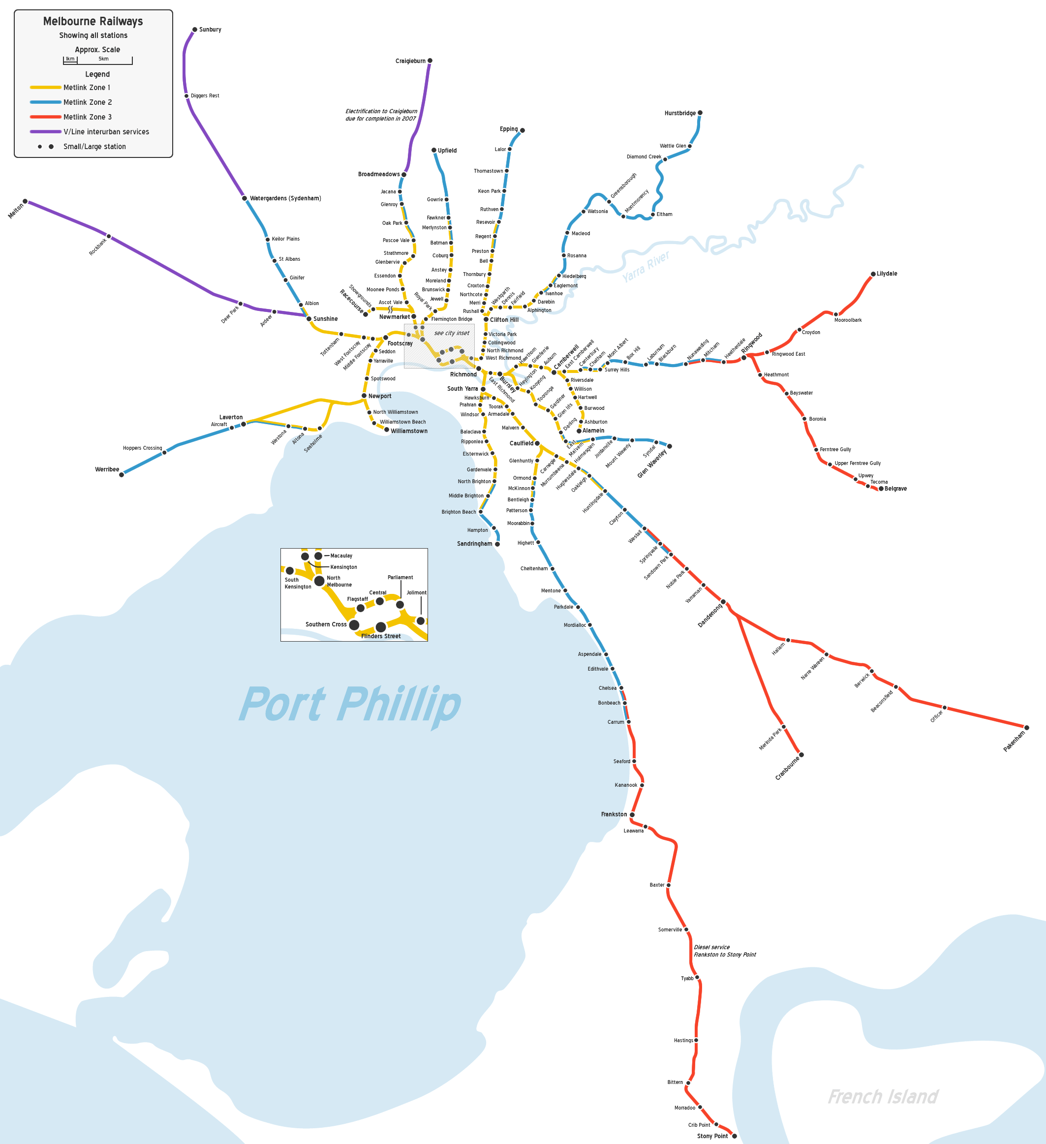
Map of Melbourne's railway network, geographically accurate, to approximate scale. Shows all stations. |
|---|---|
| Source |
Own work. |
| Date |
31st December, 2006 |
| Author | |
| Permission (Reusing this image) |
See below. |
Licensing
| This file is licensed under Creative Commons Attribution 2.5 License. |
File history
Click on a date/time to view the file as it appeared at that time.
| Date/Time | Thumbnail | Dimensions | User | Comment | |
|---|---|---|---|---|---|
| current | 07:06, 16 February 2007 | | 2,126 × 2,325 (176 KB) | Admin (talk | contribs) | == Summary == {{Information |Description=Map of Melbourne's railway network, geographically accurate, to approximate scale. Shows all stations. |Source=Own work. |Date=31st December, 2006 |Author=John Shadbolt |Permission= |other_versions= }} == Licensing == {{cc-by-2.5}} |
- You cannot overwrite this file.
File usage
The following 3 pages link to this file:
