File:Bergensbanen map.png
From TrainSpottingWorld, for Rail fans everywhere
No higher resolution available.
Bergensbanen_map.png (508 × 306 pixels, file size: 85 KB, MIME type: image/png)
Summary
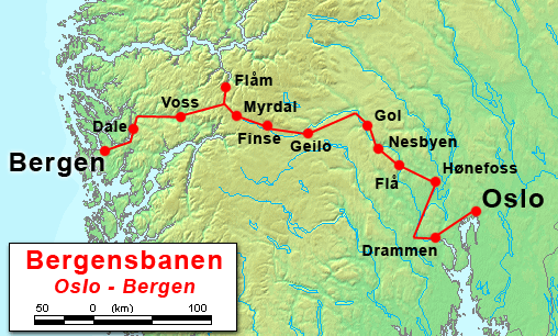
Map of the Bergensbanen, based on public domain mapping from Demis Web Map Server
By ChrisO
Licensing
I, the creator of this work, hereby release it into the public domain. This applies worldwide.
In case this is not legally possible,
I grant any entity the right to use this work for any purpose, without any conditions, unless such conditions are required by law.
File history
Click on a date/time to view the file as it appeared at that time.
| Date/Time | Thumbnail | Dimensions | User | Comment | |
|---|---|---|---|---|---|
| current | 06:53, 16 February 2007 | | 508 × 306 (85 KB) | Admin (talk | contribs) | == Summary == Map of the Bergensbanen, based on public domain mapping from Demis Web Map Server By ChrisO == Licensing == {{PD-self}} |
- You cannot overwrite this file.
File usage
The following page links to this file:
