File:Maps-sodor-railways-amoswolfe.png
From TrainSpottingWorld, for Rail fans everywhere
Size of this preview: 640 × 471 pixels. Other resolutions: 320 × 236 pixels | 1,024 × 754 pixels.
Original file (1,024 × 754 pixels, file size: 256 KB, MIME type: image/png)
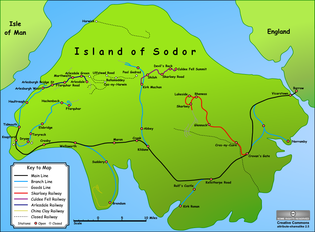
A map of the Island of Sodor from The Railway Series by Rev. W. Awdry.
Drawn by AmosWolfe on 11th September 2005, using the software package Serif DrawPlus.
A number of different maps of this island, including an original painted by Rev. Awdry can be found on this excellent website.
| This image is licensed under the Creative Commons Attribution ShareAlike License v. 2.5: http://creativecommons.org/licenses/by-sa/2.5/ |
The source file is available as a scaleable vector on request, subject to the above licence.
File history
Click on a date/time to view the file as it appeared at that time.
| Date/Time | Thumbnail | Dimensions | User | Comment | |
|---|---|---|---|---|---|
| current | 00:58, 16 February 2007 | | 1,024 × 754 (256 KB) | Admin (talk | contribs) | A map of the Island of Sodor from The Railway Series by Rev. W. Awdry. Drawn by AmosWolfe on 11th September 2005, using the software package Serif DrawPlus. A number of different maps of this island, including an original painted by Rev. Awdry can be found on [http://www.pegnsean.net/~railwayseries/mapsection.htm this excellent website]. {{cc-by-sa-2.5}} The source file is available as a scaleable vector on request, subject to the above licence. Category:Rail transport in fiction Category:Fictional maps |
- You cannot overwrite this file.
File usage
The following 10 pages link to this file:
