File:Jacksonville Skyway.jpg
From TrainSpottingWorld, for Rail fans everywhere
Size of this preview: 527 × 480 pixels. Other resolutions: 264 × 240 pixels | 807 × 735 pixels.
Original file (807 × 735 pixels, file size: 263 KB, MIME type: image/jpeg)
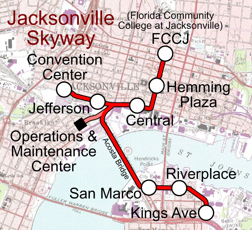
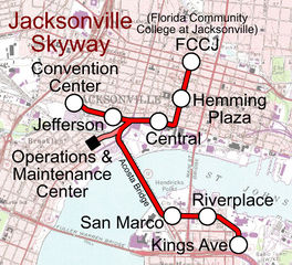
Template:Spuimap Map of the Jacksonville Skyway, superimposed on a public domain USGS topo.
File history
Click on a date/time to view the file as it appeared at that time.
| Date/Time | Thumbnail | Dimensions | User | Comment | |
|---|---|---|---|---|---|
| current | 00:23, 16 February 2007 | | 807 × 735 (263 KB) | Admin (talk | contribs) | {{spuimap}} Map of the Jacksonville Skyway, superimposed on a public domain USGS topo. Category:Railroad maps of the United States Category:Jacksonville, Florida Category:Jacksonville Skyway |
- You cannot overwrite this file.
File usage
The following page links to this file:
