File:Cape Codder map.png
From TrainSpottingWorld, for Rail fans everywhere

Size of this preview: 640 × 416 pixels. Other resolutions: 320 × 208 pixels | 1,674 × 1,089 pixels.
Original file (1,674 × 1,089 pixels, file size: 171 KB, MIME type: image/png)
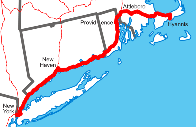
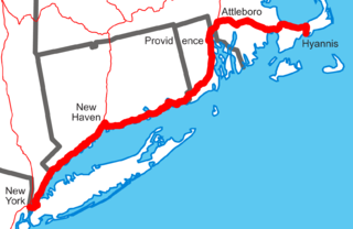
Template:Spuimap Template:PD-USGov-USGS Amtrak's Cape Codder drawn on [1].
File history
Click on a date/time to view the file as it appeared at that time.
| Date/Time | Thumbnail | Dimensions | User | Comment | |
|---|---|---|---|---|---|
| current | 22:11, 15 February 2007 | | 1,674 × 1,089 (171 KB) | Admin (talk | contribs) | {{spuimap}} {{PD-USGov-USGS}} Amtrak's ''Cape Codder'' drawn on [http://www.nationalatlas.gov/printable/images/pdf/outline/states(u).pdf]. Category:Amtrak Category:Railroad maps of the United States |
- You cannot overwrite this file.
File usage
The following page links to this file:
