File:Bnsfmap.png
From TrainSpottingWorld, for Rail fans everywhere
No higher resolution available.
Bnsfmap.png (300 × 235 pixels, file size: 26 KB, MIME type: image/png)
Summary
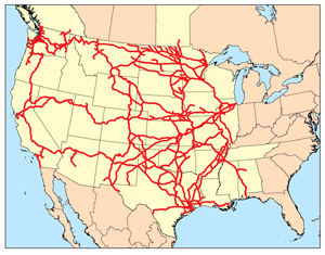
This is a map of the BNSF Network I made using DOT data.]
Licensing
|
File history
Click on a date/time to view the file as it appeared at that time.
| Date/Time | Thumbnail | Dimensions | User | Comment | |
|---|---|---|---|---|---|
| current | 01:33, 14 February 2007 | | 300 × 235 (26 KB) | Admin (talk | contribs) | == Summary == This is a map of the BNSF Network I made using DOT data. Category:Railroad maps of the United States] == Licensing == {{self|cc-by-sa-2.5}} |
- You cannot overwrite this file.
File usage
The following 2 pages link to this file:
